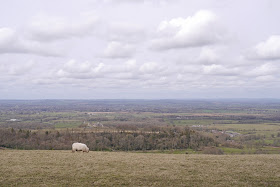
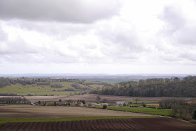
View south from Ibberton Hill
We set off from Ibberton Hill, high above Blackmore Vale, and followed the road along to Woolland Hill.
Then round the corner to continue along the road towards Bulbarrow Hill. After a while we noticed a made up path at a lower level and dropped down from the road to follow it. This wasn't totally successful as it soon turned away downhill, but it did give us a better view of some lovely old trees.
Back on the road, we crossed over to get our first view of the long curve of Bulbarrow Hill, one of the highest points in Dorset at 274m. Over to the left is Nordon Hill, on our route about 4 miles away.
Soon we could finally leave the road and walk towards Rawlsbury Camp, an iron age hill fort built on a promontory of Bulbarrow hill.
The iron age fort was impressively large (five acres) and you could make out an outer ring of defensive earthworks.
Walking away to the south west was perhaps the very best part, giving a great feeling of being on top of the world as the hill sloped away steeply on the left and open country stretched out ahead.
We now followed a downhill path towards Crockers Farm. As we got lower down it became more and more muddy, and we were grateful that we had to wade a small stream to get some of the mud off our boots. The farmland on the other side of the road was similarly muddy and it was frustrating to find that diagonal paths shown on the OS map across two fields had been ploughed over, and the signs appeared to have been subtly altered to require you to walk along two sides. There was at least a nice view back from the top of the second field.
Further field edge paths and farm tracks brought us to Melcombe Park Farm. Now we headed across another large field heading for the Dorsetshire Gap. We suddenly realised that we had walked this path before - on a walk a year ago on a walk around Ansty and Higher Melcombe. We emerged form the field to suddenly find ourselves on a ridge, with a lovely view to the left over the hamlet of Higher Melcombe. The fields to its right once contained the village of Melcombe Horsey, which disappeared after the Black Death. Higher Melcombe itself now consists of a single farm, whose 15th century manor house, built for Sir John Horsey, has a later chapel.
Ahead was the wooded area of Nordon Hill containing the Dorsetshire Gap and to the right Blackmore Vale and the wooded Melcombe Park. The Dorsetshire Gap is the intersection of four ancient paths and has the unusual feature of a Visitors Book concealed in a picnic cooler. We duly recorded our visit.
The final stage took us along a banked path with lovely primroses growing everywhere into a copse with Lily of the Valley and Bluebells waiting to flower. The Bluebells were nowhere as advanced as teh ones we saw yesterday. This led to a path a across masssive field and then a narrow track descending to the hamlet of Folly, consisting of two houses, presumably the minimum qualification to be a hamlet!
Conditions: Grey and cooler than yesterday, reaching only 10 or 11 degrees.
Distance: 6 miles.
Maps: Explorer 117 (Cerne Abbas & Bere Regis).
Rating: Three and a half stars.


No comments:
Post a Comment