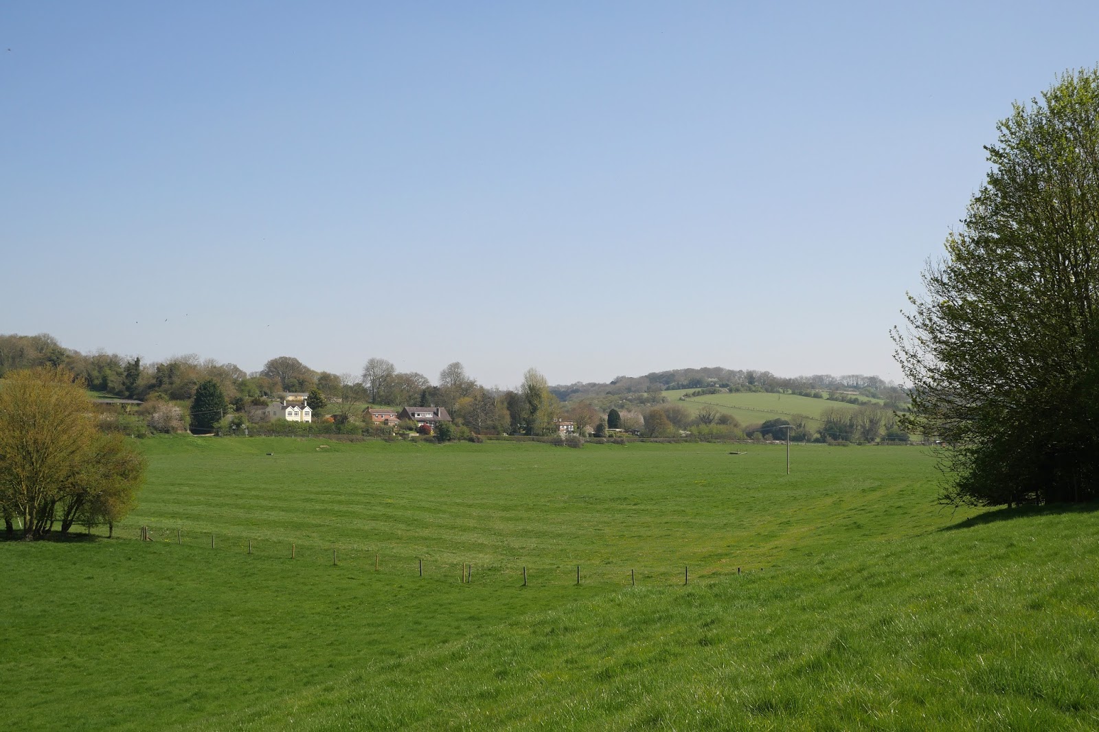
Tuesday, 25 April 2017

Olney, Clifton Reynes and Emberton

Church of St Peter and Paul

Another walk in the series that Merv and I are doing of southern towns. Previous ones include Ledbury,  Banbury and Tewkesbury. It is a bit surprising to be north of Milton Keynes and still be in the South East and to think that Olney is is in tame county as Eton - I guess they are the most northerly and southerly points.

Guided by a town trail, we started at the southern edge of the town and headed into the churchyard of St Pete and Paul. The tall 14th century spire would turn out to be visible for miles around. The church is basically 14th century with 19th century restoration by Sir George Gilbert Scott. I did rather like the colourful Victorian stained glass in the east window.
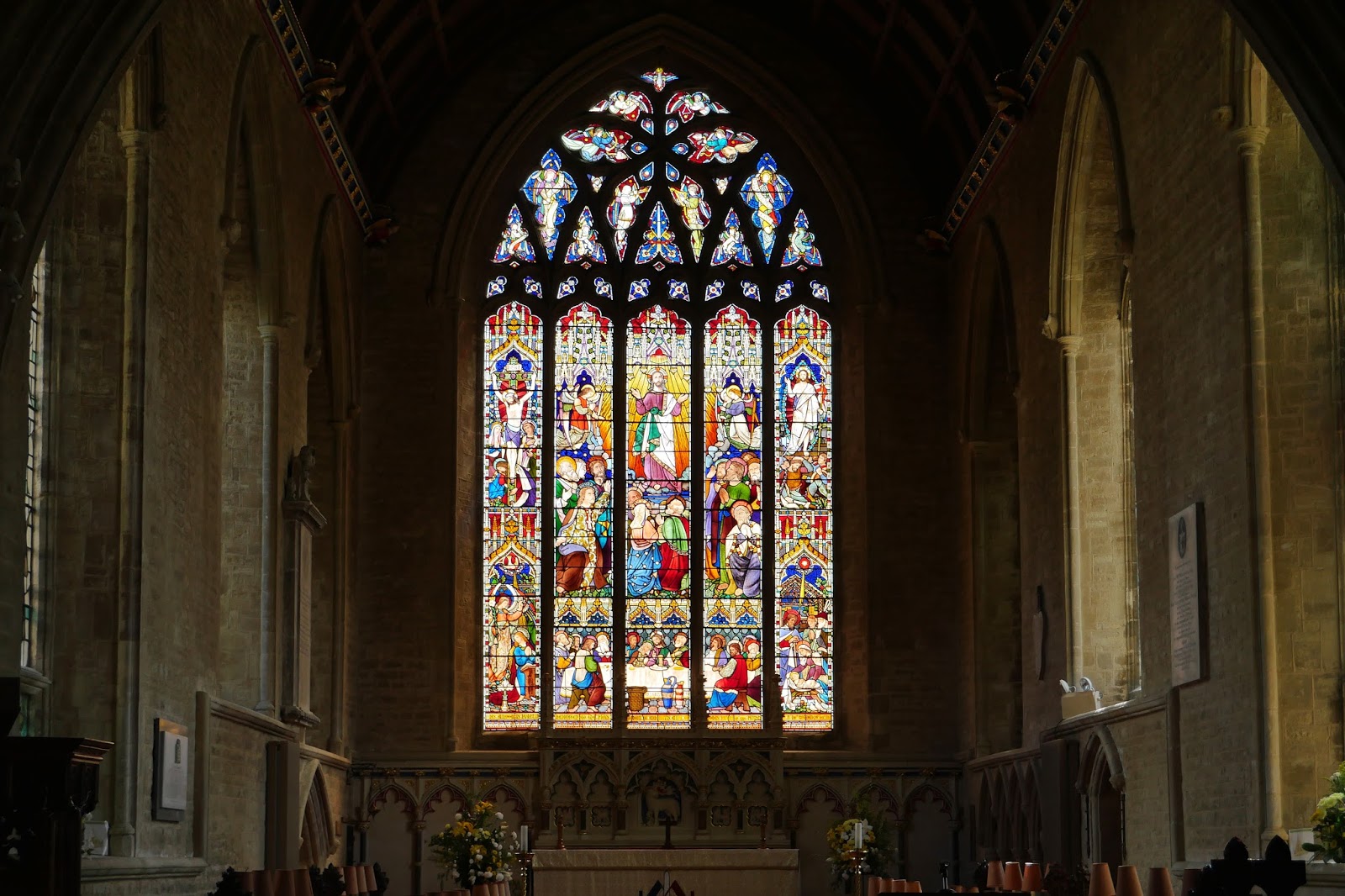

John Newton, the curate between 1764 and 1780 and the poet William Cowper wrote the Olney Hymns which include the celebrated "Amazing Grace".

Following the town trail we headed through the cemetery and curved round to enter the triangular Market Place, where on the left is the Cowper and Newton Museum. Cowper lived there with his "companion" Mary Unwin. The building dates from about 1700.


We walked up the wide side street and Pevsner points out the feature which makes it so distinctive: there are no side streets. The building are also reasonably uniform in age and size and there are lots of trees.


 On the right we noted the Bucks Lace Industry building, now a private house: "an ugly but interesting building of 1928" (Pevsner). Lace making was an important cottage industry in Olney in the past.


On the left was The Picture House, presumably the former cinema.


Further up on the left was the fantastic Orchard House (1904). Pevsner describes it as Arts and Crafts Neo-Baroque. I see it as an example of English art nouveau, albeit maybe not the finest.


Here is a bit more detail of the flower motifs and the stained glass.


 At the end of the High St is, rather surprisingly, Town Farm (early 18th century) - which still has farm buildings, looking  bit derelict, behind it.


We now retraced our steps and continued down the long High St almost to the church. We noted the how well maintained the buildings, the number of small local shops and businesses (and the absence of empty shoes or ones used as Charity shops), and the relatively small number of national chains.

On the right thee was a very fine terrace of double fronted houses - not that common.


 We passed to the side of the church and reached the bank of the Great Ouse at Mill House and were immediately walking across open grassland.


Soon we reached a point where the river turned north and we crossed a small bridge to continue on to
Clifton Reynes. There was a nice view back, reminiscent I thought of Constable's painting of Salisbury Cathedral.


There was a lovely view along the river too.


 Clifton Reynes is only a hamlet but it has a striking church Norman tower and 13th-14th century battlements and a pub which served us a very nice lunch from a surprisingly long menu.


We now navigated our way across a large grassy expanse to reach a road just near Emberton. There was another nice view of the river, meadows and church spire.


 We crossed the A509 and entered the village to see a simple neo-Gothic clock tower in the middle of the road. It was erected in 1846 by the then vicar in memory of his late wife.


Further along the same road we came to the church of All Saints, a very pleasing building of the early 14th century.


The road ended with a small council estate (but it looked as though the right to buy had been widely exercised) and then across field paths to enter Emberton Country Park, a very nicely done repurposing of some disused gravel pits.


We were pleased to spot a heron as we meanderd through the park to emerge on the A507 a short was south of where we had parked.

Conditions: quite warm. We were pleased that we managed to avoid some passing showers.

Distance: about 7.5 miles.

Map: Explorer 207 (Newport Pagnell and Northampton South).

Rating: three and a half stars.

Wednesday, 19 April 2017

Chelsea

The Royal Hospital, Chelsea

We met up with our friends John and Anne to do a partial walk around Chelsea and then have an early dinner. The walk started from Sloane Square, but the first point of note was the Royal Hospital Chelsea. It was founded by Charles II in 1662 for retired soldiers on similar lines to Les Invalides in Paris (completed 1674 under Louis XIV). The architect was Sir Christopher Wren. I hadn't realised that it was open to the public, but apart from a minor grilling at the closed gate you are made very welcome.

The Hospital is an independent charity and relies partly upon donations to cover day-to-day running costs to provide care and accommodation for veterans. Any man or woman who is over the age of 65 and served as a regular soldier may apply to become a Chelsea Pensioner (i.e. a resident), if they need and  "of good character". They must not, however, have any dependents and former Officers must have served at least 12 years in the ranks before receiving a commission.

The magnificent main building is shown above. There is also a new addition off to the left, dated 2008 ...


... and a less recent one to the right.


The central portico is flanked by two identical wings: the one on the right is the dining hall, while that on the left is the chapel (the beautiful interior is also by Wren). The painting of the Resurrection in the half dome is by Sebastiano Ricci.


Behind the main facade is an imposing courtyard, Figure Court, open on the side nearest the Thames. In the centre is a massive statue of Charles by Grinling Gibbons. It was re-gilded in honour of the Queen's Jubilee in 2002 and now looks very golden indeed.


Looking down towards the river (the area was closed today so we couldn't get any closer), we suddenly realised that we were looking at the redevelopment of the Battersea Power Station site.


We headed along Royal Hospital Road and turned left into Tite St, passing the house where Oscar Wilde lived from 1884-95 and where, at a dinner party, he met his future lover Lord Alfred Douglas. The house is not itself very distinguished. But further down the street on the other side is a house where the great painter John Singer Sargent lived - and this has a bit more visual interest.


We turned into Swan Walk to visit the Chelsea Physic Garden (or Chelsea Psychic Garden as my son's partner thought it was called). Before entering I took a picture of this classic 1930s appartment block on Royal Hospital Road


The Chelsea Physic Garden occupies 4 acres and was established by the Worshipful Society of Apothecaries (pharmacists) in 1673. In 1722, when the Society was in financial difficulties, the Lord of the Manor of Chelsea, Sir Hans Sloane, gave the Society a perpetual lease on the site for a rent of £10 per annum (now paid to the Cadogan Estate). Sloane's statue (well actually a reproduction) stands in the centre of the garden.


The garden was an absolute delight to explore and we also had a very informative and interesting guided tour by a volunteer guide. Most of the plants are there for their pharmaceutical value and we learned that the many plans whose Latin name included officialis were so-named by Linneus to denote their medicinal properties.

Among the non-medicinal plants we enjoyed this Judas Tree in full flower ...


... and the unusual Handkerchief Tree.


We returned to the embankment and admired the Peace Pagoda on the edge of Battersea Park. It was opened in 1985 and the permission to build it was the last legislative act of the Greater London Council.


On the street side this large red brick house with swan motifs was very striking.


Now into mansion land in Cheyne Walk. Perhaps the most interesting was this one, once the home of the painter Dante Gabriel Rosetti and also the poet Algernon Swinburn. (Algernon is an ancient name which apparently drives from the Norman French aux gernons, meaning "with moustaches". You don't hear it much nowadays, do you?)


Food was calling now and we headed north towards the excellent Wright Brothers Oyster Bar near South Kensington tube. I was very taken by St Luke's church in Sydney St. It was built in the 1820s, before Gothic revival churches had to be true to medieval principles. It is very striking, but seems too narrow for its height.


Conditions: surprisingly warm and sunny.

Distance: About three miles.

From: London's Hidden Walks by Stephen Millar vol 2 (Metro Publications)

Rating: four stars.

Monday, 10 April 2017

Cookham

Cookham seen from Cookham Dean

We met up with our friends Chris and Philippa to do this circular walk starting at Cookham Station which I found on Christopher Somerville's website.

We headed east towards Cookham Dean and climbed across fields to soon have a good view back. Our brief encounter with Cookham Dean consisted of a rage green with some Edwardian houses on one side ...


... and the pretentious sounding Sanctum on the Green Inn at right angles at one end. The stained glass was very attractive however.


We headed round the side of the pub and crossed fields to enter Quarry Wood. We followed a rather lovely sunken track (I should have taken a picture), but slightly lost our way and ended up close to the busy A404 road. We found a pleasant path heading in the right direction and followed it parallel to the Thames. We were puzzled to find an area to our find which was fenced off and which then had coils of razor wire inside the fence to deter intruders. What could it be?


We emerged from the wood on the edge of the scattered settlement of Cookham Dean and followed a road for a while before taking a grassy track, still parallel to the river. This was the view back at the point at which we turned towards the river to meet the tow path.


Soon we passed a rather fine scarecrow which seemed at first sight to be somebody rather formally dressed, perhaps with a shooting stick. The zoom lens photo suggests a female manikin in an all-in-one suit.


The river was wide and a bit featureless when we did finally reach it.


As we approached the eccentric but entertaining Bounty Inn on our side,  we saw Bourne End Marina on the other. The houses were rather good reproductions of Edwardian Thameside houses and seemed very much in keeping.


Next was the railway bridge, which has on this side a footbridge which looks like a later but very useful addition.


In a mile or so we reached Cookham Bridge and turned right to walk through the church yard of Holy Trinity church (Norman, with the usual later additions, alterations and renovations).


In the churchyard was a memorial to the artist Stanley Spencer (1891-1959) who was born in Cookham and spent most of his life there.


At the Junction of Ferry Lane and High Street stands the Stanley Spencer Gallery, which had been intended to be a feature of our walk - unfortunately it is closed on Monday.


We headed along the High St to pass Fernlea, the house where Spencer was born.


At the end it opens out into a wide and attractive green. At the end of this is a quite large and rather traditional-looking brick bridge which crosses a very small stream. It turned out to have been built as a memorial early in the 20th century. We spent a few entertaining minutes pondering the impact if more people had a memorial bridge built for them rather than the more usual memorial stone.


Continuing in the same direction we soon reached the station and the end of our walk.

Conditions: Cool and grey.

Distance: 7.5 miles.

From: Christopher Somerville's website. Originally published in The Times, where a word limit led to the walk description being very compressed and not easy to follow.

Rating: Three and a half stars.

Sunday, 9 April 2017

Hurstbourne Tarrant to Longparish [Test Way 2]

The Bourne valley

Yesterday we started the Test Way with Viv and Giles and today we did the second stage, setting off from Hurstbourne Tarrant towards St Mary Bourne. We initially followed a path parallel with the shallow valley in which flows the Bourne Rivulet.

This business with Bourns is a bit puzzling: according to the Oxford dictionary, a bourn (sometimes bourne, and often borne in place names)  is a "a small stream, especially one that flows intermittently or seasonally" (cf the Scottish word burn). So the Bourne rivulet is arguably the Bourne bourne.

We shortly turned right up the hillside of Wallop Hill Down and then walked through woodland to reach Stokehill Farm, a very attractive building of brick and rubble.


We now continued along a ridge which gradually converged on St Mary Bourne, with lovely views to the north-east ...


... and later towards the north.


We skirted the sprawling village, going through a series of very attractive gates which had apparently recently replaced stiles. Most also had poems by children at the local primary school.


We were now on a multi-purpose track. The bottom sign, for the Brenda Parker Way, a new one for us, led us to investigate. It seems Brenda Parker was one of those tireless volunteers who help to keep the footpath network in good shape for the benefit of us all.


On the edge of St Mary Bourne was an attractive lake and we sat on a bench overlooking it for our lunch. A plaque revealed that it had been excavated by a local doctor intending to make a haven fro wildlife. There were certainly plenty of water birds in view.


We climbed away from the village and enjoyed the view of a railway viaduct on the Basingstoke to Andover main line across the valley.


Now the landscape was of vast open fields, a very different landscape than we had experienced so far. We passed Lower Wyke Farm and crossed over a new railway bridge on the same line. We were now getting views of an extraordinary complex of buildings at what we eventually discovered was Faulkner's Down Farm. We had an amusing session trying to brainstorm what they could be


The first clue came as we got closer and saw massive quantities of sugar beet piled up in the fields on both sides of the track. Ah we thought sugar beet processing! But into what?


Some assiduous googling by Giles revealed what was going on. The site is owned by Aspley Farms and their website reveals that "Up until a year ago we farmed arable crops of wheat, spring barley and oil seed rape in a tight rotation. Due to decreasing margins we decided to invest in a bio digester and farm for energy. We now produce 4 products: electricity, gas, fertiliser and CO2." How interesting! Certainly, none of us had ever heard of a bio digester. However, I do wonder if growing crops to make energy is the right use for agricultural land. I will have to try to find out more and ponder it more.

Now surprisingly near Andover, we crossed a road and walked along the side of a massive field of rape extending along a valley.


This path led into woodland and we crossed a dismantled railway which seemed to lack the usual cycle way.


Not long afterwards we were in the aptly named Longparish, a village straggling mostly one house deep along the road for a mile and a half. There were lots of nice houses.


At the southern end is the huge Middleton House, an 18th century building with later additions.


Perhaps the most eye-catching thing however was the tower of the church of St Nicholas, an attractive Tudor addition to this church of Norman origin.


Inside, following a Victorian restoration, Minton tiles, Morris & Co glass - and this recent, but eye-catching, glass.


Conditions: sunny and warm.

Distance: 8.25 miles.

Map: Explorer 158 (Newbury & Hungerford).

Rating: four stars. Not as beautiful as yesterday, but all sorts of things of interest. Still no sign of the Test.