Thursday, 3 November 2016

Warminster to Corton (Wessex Ridgeway [Wiltshire] 7)

Battlesbury Hill

Back on the Wessex Ridgeway after a break of five months, we resume the route on the north of Warminster by the West Wilts Golf Club and take a route heading south east through a small housing estate. Reaching a road, we turn left along the side of the vast Army Training Centre and and then right to climb Battlesbury Hill with its Iron Age hill fort.

We are now back on the south east line we started on and on the far side of Battlesbury (208m)there is a nice view across to Middle Hill, with its two lonely trees and an area of Strip Lynchets over to the left. They are the result of ancient farming methods, although there is some debate about they were deliberately created (like the terraces found in countries around the Mediterrranean) or were the by-product of slippage of soil loosened by ploughing.


We crossed the low-lying area in front of Middle Hill and followed a line to the right of the trees to climb a third hill, Scratchbury Hill. This is the view back.


We were now on a high ridge, still heading south east. We passed a small tumulus with a helpful sign advising tank crews that they were not to shell it or drive over it and then passed through a narrow strip of woodland.


We turned right immediately on the other side and headed downhill towards the village of Heytesbury. Our first sight was of the church through some nice autumn foliage.


After crossing the busy A36 we found ourselves in the village centre and walked along the High St to get a closer view of the church (of St Peter and St Paul). It dates from the 13th-14th centuries, but was in Pevsner's view over-restored in the 19th century by William Butterfield. It is "externally more rewarding from a distance than from near by".


Further along the High St is the former Lockup.


And at the end is the Hospital of St John and St Katherine. This almshouse dates from 1449 and was founded by Walter, Lord Hungerford, Treasurer of England. It was rebuilt in 1769 and modified internally in 1962.


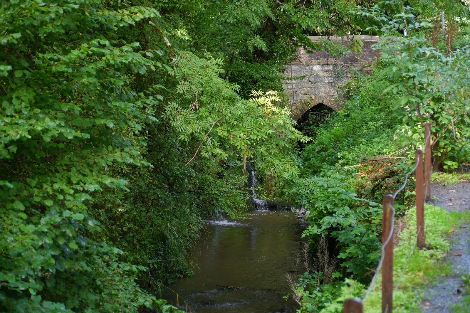
We were now at the start of the Wylye Valley and soon reached the banks of this attractive stream.


Another mile or so brought us across fields to the edge of the village of Corton and then to The Dove pub where we enjoyed an excellent lunch.

Conditions: not too cold, cloudy.

Distance: 6.8 miles.

Map: Explorer 143 (Warminster & Trowbridge).

Rating: four stars.

Thursday, 13 October 2016

Petworth to Sutton End (Lord's Piece)

Petworth House and church seen from the east

We are back on the Serpent Trail with Viv and Giles after a longish break. We set off from the car park in the centre of the town and walk through quiet streets towards the eastern edge. I liked this terrace of houses - somewhat like almshouses, but more probably estate cottages.


A bit further on we enter a narrow track passing through an unusual type of stile - in fact, a turnstile. I have never seen one before in the country.


At the bottom we cross the A283 and, ignoring a second turnstile, begin our descent into a superb glassy valley


When we reach the far side we enjoy the view back and I am struck by how fine are the horses grazing in the top field. I am not usually that interested in horses, but these seem especially impressive.


We pass a house and enter an area of woodland, continuing east along a pleasant track. We emerge at a minor road and cross into Flexham Park, a large area of commercial woodland. At the end we pass through the hamlet of Bedham and turn off to the south. We pause for a picnic in a rare area of open country and enjoy the splendid views towards the South Downs.  Unfortunately, the sun is (reasonably enough at lunchtime!) in the south too, so this photo isn't much.


Continuing, we soon in more woodland and notice these curious tent-like shapes off to the left. Gradually it dawns on us that they must be for BMX biking or something similar.


The route gradually becomes more open and we pass through the edge of the village of Fittleworth to reach Hesworth Common. The sun through the trees was delightful.


We emerge onto a small plateau, not high (only 69 meters in fact) but offering fine views to the S0uth Downs - the view is actually very similar to the one above - we are only a couple of miles further south.


I enjoyed a nostalgic moment passing this tree with its swinging rope. There used to be a similar one, with an old tyre to hold onto, in Oxshott Common near where I was brought up.


At the edge of the Common we pass the attractive Hesworth Grange ...


... and emerge onto the B2138 at Lower Fittleworth, where The Swan Inn has an unusual gantry supporting its signboard. We saw something similar in Stamford earlier in the year and that one was originally used as a gibbet. I somehow doubt that the Swan's was also.


We follow the road for a bit, cross a bridge over the River Rother.


A track to the right takes us to our end point at Lord's Piece car park, passing, rather surprisingly a large showroom for sofas. From the car there are lovely views of the scattered trees in what feels like the park of a great house. Looking on the map I can see that Coates Castle (an 1820 Gothick manor house) is just to the north, so perhaps this impression is correct.)


Conditions: quite cold, but also sunny.

Distance: 8.8 miles (distance now covered 40.7 miles).

Rating: four stars.

Monday, 3 October 2016

Warwick Castle

The oldest part of the castle

We are in Warwick to meet old friends Roger and Deborah: it's basically halfway (and more inviting that the exact half point as defined by the excellent What's Halfway website which was Bedford). None of us had been round the castle so we decided to make that the focus, although we were slightly concerned that it might too much like a theme park.

The castle was originally founded, as so many were, by William the Conqueror, in 1068 as a simple motte-and-bailey. Stone buildings were added from the 13th century.

We enter through the electronic turnstiles and immediately have a great view of the imposing oldest parts of the castle. Unfortunately, we are looking directly into the sun and so the best I could manage as a photo is just one corner: the magnificent Guy's Tower. It is the tallest of the three main towers at 128 ft and has twelve sides. It was completed in 1394.


We head round to the splendid gatehouse, which is revealed as two towers, one behind the other. There is a great view looking up into the Clock Tower.


Once we are inside the castle, its scale becomes apparent, as do some small theme-park features (music, tents and huts serving food and drink, the dungeons). The picture at the head of this post shows the wonderful view looking back towards the Gatehouse across the large grassy area in the middle of the castle. The third old tower, Caesar's Tower, is on the right. It is irregularly shaped and awkwardly located, so hard to photograph.

We are delighted to find that there is a partial wall around the walls and head off to the right to climb some steps onto a walkway which leads to Guy's Tower. The views from the top are wonderful. Looking down into the castle you can see the mainly Victorian buildings on the left and the original motte ahead and to the right - it was later landscaped and made picturesque.

Looking out from Guy's Tower there is a great view of the town and especially the great church of St Mary. It was originally completed in 1394, like much of the castle, but was almost completely destroyed by the Fire of Warwick in 1694. Rebuilding was complete by 1704.


We descended back to the walkway and enjoyed a nice juxtaposition of Guy's Tower and the tower of St Mary's.


Climbing the Gatehouse Tower brought us fine views over open country as far as Kenilworth, another fine Warwickshire castle. More immediately, we looked down on the delightful Mill Street.


Just off to the right was the Old Bridge over the River Avon. It dates from 1374-83.


We continued through Caesar's Tower and down to explore the rest of the castle and the motte. The views over the countryside were pleasant enough. Outside the walls we watched the popular Birds of Prey show for a short while and were impressed to see just how big a Lammergeyer actually is. After that it remained only to head into town to find the Market Place and enjoy an excellent lunch at the Rose and Crown, sitting outside in the surprisingly warm sun.

Distance: very little.

Conditions: bright and sunny. Warm.

Rating: Four and half stars. A great day out. Our theme park fears were largely unfounded.

Saturday, 1 October 2016

Wootton Fitzpaine to Lyme Regis (Wessex Ridgeway [Dorset] 10)

Lyme Regis

The final stage of the Wessex Ridgeway. We set off from Wootton Fitzpaine walking along the road for a while and then turned left along a track and then field paths to pass this isolated but rather lovely cottage.


The tree covered Thistle Hill was on our left, with some pleasant green open areas.


After crossing a couple of fields, the path disappeared into woodland and suddenly emerged in a garden adjoining a couple of holiday cottages. This entertaining home-made statue gave us a start.


Soon after this we came out into open fields to reach Stubbs Farm where we turned left and began a long winding climb towards Penn Farm. As we approached, there was a fabulous panorama back towards the north-east.


Just before we reached the busy A35, there was this even more wonderful view, slightly more to the north.


We crossed the road and headed down a very uneven field to enter Hole Common, actually a wood. It felt a little tropical with lots of ivy hanging down from the trees.


We walked through this delightful wood and emerged onto a track which brought us to Dragon's Hill. We descended the gentler west side and soon reached the river Lim, from which Lyme Regis of course takes its name. There is a wonderful quiet lane which follows the bank of the river, more of a stream really, all the way into the town. Coming ion by road is much less enjoyable. The river was tricky to photograph as it was now dark and raining, but eventually this lovely gothic bridge offered a view looking back.


We followed the lane right into the heart of the town, passing the splendid Town Mill. There has been a water mill in Lyme since the 11th century and parts of the present building (restored in 2001) date back to 1340.


You can in fact follow the Lim until it joins the sea.


Off to the left is the Guildhall. It is a picturesque construction dating from 1886-7, the work of a sadly unknown architect. Pevsner is rather dismissive, but I found it charmingly picturesque.


We continued on to the sea front and enjoyed the view east along the coast to Golden Cap. We walked over Golden Cap in April 2012 in the early days of doing the South West Coast Path, and reached a rather cloudy Lyme two days later (we were doing day walks at that point). It was much more enjoyable today.


When we reached Lyme on the Coast Path we celebrated with lunch at Mark Hix's restaurant, pleased to have walked the whole coast of Dorset. Over that lunch we decided we would try to complete the whole thing - 630 miles to Minehead. We reached Bude last year (530 miles from the start in Poole) and plan to finish it next year. Finishing the Wessex Ridgeway in Dorset seemed to require a similar celebration and we enjoyed another fine meal at Hix.

Conditions: sunny, with a few sharp showers.

Distance: 6.2 miles. Distance now walked 61 miles.

Map: Explorer 116 (Lyme Regis & Bridport).

Rating: four and a half stars.

Friday, 30 September 2016

Blackdown Hill to Wootton Fitzpaine (Wessex Ridgeway [Dorset] 9)

From Blackdown Hill towards Pilsdon Pen and Lewesdon Hill

We are nearly at the end of the Dorset section of the Wessex Ridgeway and we've decided on a two-day push to complete it. We pick up the route at Cole's Cross and begin the steady climb up to the top of Blackdown Hill. There is soon a great view back to the southeast of the last two hills we traversed last time: Pilsdon Pen and Lewesdon Hill.

We walk north along the spine of the hill and at the end take a left instead of passing through this inviting gate.


This track descends to join a minor road which leads to the hamlet of Synderford. We take a left and climb up to Yew Tree Farm - we are now heading south, parallel with the ridge of Blackdown Hill. We climb again and follow a field-edge path. Unfortunately, there are extensive electric fences dividing the large field into sections, and none of the gates that farmers usually provide. Eventually we swing right beside a wood. And this large field, a pristine Red Admiral comes and lands right by us to brighten our day.


We cross a road and continue along a track to reach Grighay Farm, rather a handsome building.


Then along farm tracks and across a small field and into a narrow and rather mysterious wood. While we are in the wood it comes on to rain and we emerge into a much more gloomy and damp landscape by Gashay Farm.


We emerge at a road having climbed a large field. There is a pleasant enough view back.


The road soon leads to a complicated junction of small lanes and we follow Hawsmoor Hill, a narrow tarmaced road, to reach Lambert's Castle, a large and rather wonderful iron age hill fort. As we head across it there is a stupendous view to the south and east. It was actually rather hazy and I have used the Haze removal tool in my newly updated version of Photoshop Elements to remove it. The result is a bit too blue, but you can certainly see the horizon more clearly.

The dip in the coastline over to the right is formed by Ridge Cliff on the left and Golden Cap on the right. If you look to the far left, the broad sweep of Chesil Beach is visible, with Portland beyond it.


From the far side of Lambert's Castle we followed a road due south through Coney's Castle and then took a right down towards Wootton Fitzpaine, where we had left the car. The route now went through a massive field of sweetcorn. It was not well marked and we duly lost our way for a while which was a bit frustrating. However, we eventually found our way downhill to the village.

We had parked opposite these fine gates which presumably lead round to the manor house.


Through the gates, just off to the right, is the village church. It is originally 13th century, but has the usual Victorian restorations. Wootton House (I presume) can be seen off to the right - dating from 1765 according to Pevsner, but extended in 1896-7.


Conditions: a lovely sunny day initially, but cloudy and damp later.

Distance: 7.8 miles.

Rating: four stars. Lambert's Castle is arguably one of the most splendid hills in Dorset.