Pages

Wednesday, 19 May 2021

Corfe Castle and Church Knowle


Corfe Castle

We had arranged to meet up with friends at the pub in Church Knowle, but it struck us that we could make an even better day of it by parking at the NT car park at Corfe and walking the two or so miles to Church Knowle, having lunch and then returning via a different route. Above is the view of Corfe that you see from the area near to the car park. It is the remains of the original Great Tower dating from the 11th century. Further fortification took place over the next hundred years and by about 1280 the castle could be described as fully fortified. It was sold into private ownership in 1407, reverted to the Crown and then passed to Sir Christopher Hatton in 1572 who made some further improvements to the defences.

The Castle was a Royalist stronghold in the Civil War, but was captured by Parliamentary troops in 1646. It was then "slighted" i.e. put beyond use by explosives, leaving the picturesque ruin you see today. It remained in the Banks family until 1981 when it was bequeathed to the National Trust, along with the family's more palatial home, Kingston Lacy.

We crossed the road from the car park and walked ahead with the castle on our left. We were struck by the scale of the Castle, never having seen it from this angle.

We climbed a grassy path away from the Castle and soon had this delightful view behind us.

We followed Knowle Hill along a hill top with a valley to the left and the coast in the distance.

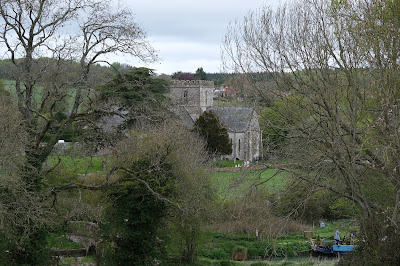
After a while we could make out Church Knowle in the valley to our left and managed to find the right path to take us down into the main (almost only) street of Church Knowle. We had a most enjoyable meal and a good chat with our friends and then walked along the street to the church of St Peter.

It dates from the early 13th century. The west tower with its pyramid roof was rebuilt in 1741.

We turned right here and followed a narrow road past a few houses to a track when led us across a grassy area to reach to almost hidden Corfe River. We followed the stream in the direction of Corfe, with the tower of the church at Kingston (the work of the great Victorian architect G E Street) visible on its high point.

We passed an intriguing group of buildings on our left, West Bucknowle House ...

... and gradually moved away from the stream. Soon there was a fine view of the long ridge that runs from Corfe down towards Swanage. It is a really fine walk which we have done a couple of times.

Now the Castle came into view again, but from a viewpoint previously unknown to us. Its natural defensive characteristics are more clear than from any other angle.

This was even more the case as we got nearer.

Having skirted the castle at some distance we entered the village passing the large church of St Edward, King and Martyr (a church dedication I have never previously heard of). It is by T H Wyatt and dates from 1859-60.

Just beyond the church is the Town Hall of 1774. It claims to be the smallest Town Hall in the country.


Not long after this we passed the entrance to the castle and walked down the hill to retrieve our car from the car park.

Conditions: bright and sunny.

Distance: about 4 miles.

Map: OL 15 (Purbeck and South Dorset)

Rating: four stars.

Sunday, 9 May 2021

Great Bedwyn & Crofton

The lock on the Kennet & Avon Canal at Great Bedwyn

This walk overlaps with two other walks we have done from Great Bedwyn: one to Wilton and the other to Crofton. It was still very enjoyable.

We started from the car park by the Canal and headed southwest along the tow path to the first lock where we left the tow path and climbed up a grassy hill. I paused after a while to take a different picture of the church of St Mary the Virgin than previously.

We headed across a field and entered some very muddy woodland to meet a broad path where left came from Bedwyn and right was signposted Windmill (i.e. Wilton). Soon we passed through a delightful stand of beech wood ...

... and soon after, the first concentration of bluebells we have seen this year. There would be several more.

We continued along this main path until we reached Bedwyn Brail and these two interesting wooden sculptures.

We turned right here and headed towards Wilton Brail, going downhill, across a quiet road and then up again. This is the view looking back.

We turned left in Wilton Brail and continued along the track emerging into a large field on the edge of Wilton.  On our left was surely the largest haystack I have ever seen.

A bit further along there was a nice view of the Wilton Windmill. It dates from 1821, after the Canal was opened. It continued in operation for a hundred years, but by 1931 it was derelict. It was restored in 1971 and now produces stone-ground wholemeal flour.

We reached a lane and turned right along a track leading to the canal and the railway.

It remained only to walk about a mile and a half along the tow path to return to our starting point in Bedwyn.

Conditions: grey, but pleasant enough.

Distance: 5.5 miles.

Map: Explorer 157 (Marlborough & Savernake Forest)

Rating: four stars.