Pages

Monday, 30 August 2010

Stanton to Hailes Abbey (Cotswold Way 3)

Stanton

After a break for summer holidays we resume our walk along the Cotswold Way with Merv and Pud. We started from the Mount Inn in Stanton, walked down the street and turn left into Stanford's other main street. Both are delightfully full of lovely houses on golden Cotswold stone. Stanford is less well-known than Broadway, and smaller, but certainly as pretty.
We now crossed a series of fields, but the feel was of walking through the park of a great house.


And in due course we came to Stanway, which has a great house, Stanway House, so perhaps it was its park we had been walking through. We first passed St Peter's church which dates from the 12th century, although the interior reflects a late-Victorian restoration.

Just a short way further on is the remarkable gateway of Stanway House, which was sadly closed for the year (it is only open June-August).


Pevsner comments that it looks Jacobean, but may date from as late as 1700. The house itself is Jacobean, with 18th and 19th century additions. According to its website, the glory of the Stanway water garden is the single-jet fountain in the Canal, opened in 2004. It rises to over 300 feet, making it the tallest fountain in Britain and the tallest gravity fountain in the world. We plan to go back next summer to see it and the house.

From Stanway the route leads to the hamlet of Wood Stanway. From here the you climb past a series of fields with obvious signs of medieval plough and furrow cultivation. This field was especially interesting: it had been leveled off, but the furrows can still be seen beneath the grass.


The path climbed steadily, but offered fine views back towards the north.


At the top, the helpfully-provided seat was already occupied, so we headed on to Stumps Cross where we turned right beside fields to pass Beckbury Camp, an iron age hill fort. A bit further on is a stone monument. There are many other blog posts and photos bout it, but no-one seems to know what it commemorates.

From here you begin a steady descent to Hailes Abbey.


The ruins of this Cistercian Abbey sit in a tranquil location. The Cistercians were an offshoot of the Benedictines whose goal was to return to the strict observance of the rule of St Benedict. Their name comes from the first monastery they founded which was Citeaux near Dijon in France in 1098.

Hailes Abbey was founded by Richard, Earl of Cornwall, brother of Henry III in 1246. Needless to say, the destruction of the abbey was part of Henry VIII's dissolution of the monasteries. The site was given to his surviving queen, Katherine Parr and a country house was later built on the site, but by 1794 it too was a ruin.

Almost opposite is the tiny, rather abandoned, church. It dates from about 1130, so about a hundred years before the abbey.


There are some lovely (Pevsner says 13th century) wall paintings, of which this is the best preserved.


Conditions: warm and sunny.

Distance: about 6 miles.

Maps: Explorer OL45 (The Cotswolds).

Rating: four stars. Great views, interesting buildings.

Friday, 27 August 2010

Liverpool: Albert Dock to Liverpool Cathedral

Liverpool (Anglican) Cathedral

In Liverpool on a family visit, we improvised this excellent city walk. We started at Albert Dock, where we were staying, and set off in the broad direction of the Cathedral. We walked along Park Lane and came on the fantastic Swedish Seamen's Church (Gustav Adolfs Kyrke) of 1883-34 by WD Caroe.


A bit further up is the Catholic church of St Vincent de Paul (1856-7) by Edward Welby Pugin (son of the much more famous AWN Pugin of Houses of Parliament fame). The wooden bellcote is noteworthy and the red brick Presbytery, around the corner, tucked in beside the church has trefoil heads over every window.


We reached the Cathedral at one corner (to the right in the photo at the head of this post) and walked along its length to find the main entrance at the west end. (In fact we were interested to to discover that the "west" end actually faces more or less due north. I had always naively imagined that churches were literally arranged with the altar at the east end, but I suppose it is obvious that the constraints of the site mean that east and west are sometimes notional.)

We enjoyed the view down over the graveyard, which was apparently once a quarry,


The Cathedral itself was designed by St Giles Gilbert Scott, who won the architectural competition for it aged only 22 (perhaps his eminent father, Sir George, helped). The diocese had only been founded in 1880. Work started in 1904 and the lady chapel was completed by 1910 at which point dramatically changed his own design, replacing the twin towers of his original with the single massive tower you can see today. There is a model of the original design in the Cathedral.

The Cathedral was not finally completed until 1978 and had been damaged in the war. It has a sense of massive, if rather incoherent, space and stylistic unity. The Pevsner Architectural Guide to Liverpool by Joseph Sharples describes it as "the final flowering of the Gothic Revival as a vital, creative movement" and as "one of the great buildings of the C20".

We went to the top of the 331 foot high tower and enjoyed the views. This one shows Albert Dock, with the nearly finished Museum of Liverpool just to the right.


We took a slight different return route, heading past the small Greek temple-like Oratory and down Upper Duke St, past the wide Georgian Rodney St.


A bit further on we came to the former Great George St Congregational church of 1841.


Sharples describes this as "an outstandingly successful building".

From here we walked through Chinatown back down to Park Lane and thence to Albert Dock.

Conditions: warm, sunny.

Distance: about 3 miles.

Rating: four stars.

Note: I did a previous walk around the City Centre.

Thursday, 19 August 2010

New York: Central Park

In Central Park

We had spent most of the day at the wonderful Metropolitan Museum of Art - a cross between the National Gallery and the British Museum. Overwhelmed by its wonders, we decided on a diagonal walk across Central Park to clear our heads. It was designed by the same Frederick Olmsted who was responsible for Parc du Mont Real in Montreal.
We made our way to the Obelisk which stands behind the museum.


It is known as Cleopatra's Needle, although it has nothing to do with her. It is however ancient Egyptian and does have a fascinating history. It is one of a pair with the one on the Embankment in London. They are made of red granite and are about 21m high. They were originally erected in Heliopolis by Thutmose III in about 1450 BC and teh inscriptions were added by Rameses II about 200 years later. In 12BC they were moved to Alexandria by the Romans. It was requested as a gift from the government of Egypt by the City of New York, with the intention of matching London and also Paris (in Place de la Concorde).

We walked north from the Obelisk to follow a track along the east side of the massive Jackie Onassis reservoir. The view was impressive, and it reminded me of the lake at Fontainebleau which we walked around last year.


After a slight struggle we found our way across one of the roads which cross Central Park and headed diagonally to reach The Pool.


We were surprised to find someone fishing in this prettily landscaped pond. We then walked down to west 96th street to catch the subway back to our hotel.

Conditions: sunny and hot.

Distance: a couple of miles.

Rating: three and a half stars.


Sightings

I finally got a clear sight of the large orange butterfly which has been teasing me throughout our north American trip - it is a Monarch. Probably obvious in retrospect. We saw two in quick succession beside the reservoir and then they, seemingly instantly, set about mating.

Monday, 16 August 2010

Montreal: Parc du Mont-Real


Montreal from Parc Mont-Royal

For today’s walk we headed north from our hotel to climb Mont Real and explore the large park which now occupies it. We walked up Peel (having acquired the North American habit of dropping the Street, Avenue, Boulevard or whatever off road names) for a couple of blocks and entered the park. It was raining quite heavily and we decided to take the direct route up to the belvedere: there is a choice between the wide path which makes the climb by means of a gentle switchback and a series of staircases.

The first couple of staircases were fairly short and gentle, but then we came to the big one. We counted 250 steps.


We struggled up, but were impressed by the number of people who seemed to glide or even run up it. When we came back down later in the day it became clear that a significant number of people were using it as a training resource and were going up and down repeatedly. We saw stop watches, heart monitors and intermittent leg stretches.

A further sloping path brought us to the belvedere - not the highest point on Mont Real, but the one offering the best views. I am not sure however that the Montreal skyline is especially interesting (see the photo at the head of this post).

We now struck out along Chemin Olmsted, named for the designer of the Park. He also designed Central Park in New York and some others in north America. Apparently not all of his vision for Mont-Real was realised.

After a short while we passed Maison Smith (a stone 19th century building which is now a cafe) and left it via a field of stone sculptures.


Further along the path came to Lac de Castors (Beavers). We had a fantasy of having a nice lunch at the Pavilion restaurant, but it was closed. The cafe, which was open, was not sufficiently inspiring.


On the slope opposite a youngish man was using a metal detector with great care and attention, moving slowly upwards with frequent investigative stops. We did not hear any cries of Eureka.

We retraced our steps to the belvedere and took a loop behind it in search of La Croix. This felt more like walking along a country lane. After climbing for some time, we came on what seemed to be the highest point, a modern cross to the god of telecommunications. All roads led down from here, so we retraced our steps - the real cross was evidently a bit further on.


It seemed that autumn was coming early to one of the maple trees here.


We now followed the multiple staircases back down and exited the park to pound the streets in search of a bakery for some bread for a picnic dinner.

Conditions: fresh and wet at first, becoming hot and humid.

Distance: 5 miles.

Rating: three stars.


Sightings

I saw but couldn’t photograph a beautiful Black Swallowtail (papilio polyxenes) and finally identified the large orange butterfly which I have seen intermittently as a Monarch. Obvious, really. There was also a Red Admiral, which seemed identical to the ones we see at home.

I am not quite sure what this is, but I admired its shape.


Montreal: Vieux Montreal

Notre Dame

After two days' outings to the Laurentians, we have dumped the hire car and are now going to explore the city, starting with Vieux Montreal, the 18th and 19th century origins of the city. The walk starts in Place des Armes with the Banque de Montreal, a Palladian structure, on one side and the Basilica of Notre Dame opposite. Notre Dame was designed in 1824 and has a most extraordinarily colourful interior. Every surface is decorated, but the effect is somehow more harmonious and tasteful than in many baroque churches. The interesting-sounding seminary next door was unfortunately closed for restoration.

The third side of the square has two fantastic buildings. The red brick Edifice New York life was Montreal's first sky scraper in 1888. The Edifice Aldred dates from 1931 and resembles the Empire State Building, completed in the same year. We sneaked in and were thrilled by the pristine Art Deco interior. (The fourth side of the square is occupied by a large, discordant modern block.)


The square itself, which is also being restored, was the site of hand to hand fighting between French settlers and Iroquois warriors. The French were led by Paul de Chomedey, Sieur de Maisonneuve, the founder of the city, and these events are commemorated by a statue and inscriptions. It does seem to represent a very traditional view of history, with savages being defeated by heroic Europeans. It was after all Iroquois territory.

From here we walked a mile or so east along rue de Notre Dame. The most interesting sight was the statue of Lord Nelson on a column, facing one of his French counterpart, Jean Vauquelin, the commander of the French fleet in New France. The droll thing is that the statue of Nelson dates from 1809 - the more famous one in London, on its much higher column, was constructed in 1840-43.


Other things of note along here are the old Palais de Justice, City Hall and Chateau Ramezay.

We turned right into rue Bonsecours and enjoyed a refreshing break in the courtyard of Pierre de Calvet's house (an 18th century house, now a hotel). At the end of the short street is the chapel of Notre-Dame-de-bon-secours.


This church was founded in 1675 by Margaret Bourgeoys, a French nun who was canonised in 1982. The present building dates from the late 18th century. There is some nice stained glass and the surrounds of the windows are decorated with beautiful tiled patterns. The church also houses a museum to its founder.

The real value of visiting the church however is that you can climb the tower (accessed via the museum, so you have to pay). So we climbed the church tower and enjoyed the excellent views over the old port and the St Laurence river beyond. We especially loved the twin statues of angels, one on each side.


We now walked along rue St Paul, the main street of the old town and passed the huge Marche Bon Secours with its grand dome. Further along, the Place Jacques-Cartier is a touristy, but still very appealing square and we enjoyed surprisingly good fish lunch at one of the restaurants, La Maree.

The street gets busier from here and is full of restaurants and little boutiques. Further on you come to the handsome former Customs House (1836-8).


You now turn towards the port on rue St-Francois-Xavier and right into Place d'Youville where you pass the so-called Ecuries (stables) d'Youville. These pleasant stone buildings seem in fact to have been store rooms rather than stables, and belonged to the Gray Nuns, whose convent was nearby.

To my eyes, the wonderful red brick former Fire Station, just further along the square, was much more striking. It is now a museum.


The end of the walk is the Hospital of the Gray Nuns, with the (to be honest, not very interesting) ruins of its chapel. This order, known formally as the Sisters of Charity of Montreal, was founded by Margaret d'Youville, hence the name of the nearby square.

It was raining by now and we decided to call it a day and head for one of the few wine shops we had spotted to stock up for the day’s aperitif.

Conditions: gray, mild, ultimately rainy.

Distance: about 2.5 miles.

Rating: three and half stars.

Saturday, 14 August 2010

Mont Tremblant


Mont Tremblant from the Edge Peak

Our efforts to find a walk in the Laurentians produced the discovery that you could reach the top of Mont Tremblant, Eastern Canada's highest peak (875m), by cable car and then walk along various trails. We were a little off-put however by the description in our guide book of the Mont Tremblant resort as being like a cross between Aspen and Disneyland.

We found our way to the Mont Tremblant resort, after being given directions and a map by an exceptionally helpfully hotelier in the nearby Mont Tremblant village. After parking, you walk to a reception area where there is a free sort of ski lift which takes you on a shallow climb above hotels and swimming pools to the main resort plaza. Here you can enjoy sundry amusements and get the "gondola" to the top.

You can't see the top as yet, because it is a relatively shallow climb. The ride to the top is however quite serene. When you get there it is really not too bad - just one cafe, a couple of other cable cars and a radio mast. We followed the signs and the map we collected earlier for our chosen walk to the next peak to the west, the Edge Peak.

The views over the hills to the north were very pleasing.


And as we headed along the ridge, the view south over Lake Tremblant was even more impressive. It was startlingly long!


We walked along a track then through a forest and then back on the track to reach the Edge Peak. From here there was a good view back to Mont Tremblant and a nice view forward over the Laurentians.


We went onwards for a while through very pleasant, but quite arduous, woodland in the direction of the Johansen Peak, another 3 km along the way.


After a while however we had to turn round as the deadline for returning our hire car was fast approaching. Once we reached the Edge Peak, the return route was via a further stretch of hilly, rocky woodland.

Conditions: warm, hazy sunshine.

Distance: about 4 miles.

Rating: four stars.


Sightings

Along the open track and by a sheltered clump of flowers at the end we spotted some lovely butterflies. There were a couple more of the Pearl-bordered Fritillaries we saw at St-Adolphe-d’Howard yesterday and another similar, but smaller, fritillary with a solid dark marking along the hind edges of its wings.

However, the highlight was this Eastern Comma. It is similar to our familiar English one, but with much more strongly marked wing margins.


Friday, 13 August 2010

Saint-Adolphe-d'Howard


In Montreal now and we wanted to walk in the Laurentian Mountains, an hour or so to the north. Finding a place to walk was not so easy, since Canada lacks the network of public footpaths paths we are so used to at home. The concierge at our hotel came up with the Centre de Plein Air at Saint-Adolphe-d'Howard.

When we arrived we discovered an information point which turned out to be a campsite - which was the Centre. The girl behind the counter spoke almost no English, which staggered me, but I just about got by in French. There was a range of trails available - on payment of an entry fee. We have never had to pay to go walking before, but there is a first time for everything!

We chose a combination of trails to make a five mile walk and set off. Within few moments we had left the campsite area and were in deep pine woods. A short way along a sign pointed to a view point and after quite a steep climb we came to a viewing platform with a lovely view over the lake to the north. Perhaps this was going to be OK after all.


Further on, we headed off - erroneously as it turned out - along a trail to the left. The ground was marshy and soon we were walking a long a walkway made of tree trunks. We had a few jests about walking along trunk routes, ha ha. But soon it petered out and we had to retrace our steps.


We made another little detour across a quite pretty little lake ...


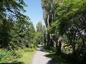
... and then settled down to complete the circuit, mainly through woodland but also with a swampy area for variety.

Conditions:sunny, hot.

Distance: about 5 miles.

Rating: three stars. An odd experience, as we were always conscious of being in a highly organised network of paths. But actually the walk itself was very pleasant and enjoyable, if a bit enclosed in the woods, and we scarcely saw anyone else. And as bonus, there were some nice butterflies ...


Butterflies of the day

I saw three orange butterflies of various sizes which I could neither photograph nor identify with any certainty. This however was definitely a Pearl-bordered Fritillary.


The other confirmed sighting was an (American) Western White Admiral (Limentis arthemis rubafasciata). Like a European one, but with rows of red and blue dashes on the upper wings, and pronounced red spots and blue dashes on the underwings. Fantastic.

Thursday, 12 August 2010

Domaine Jolie de Lotbiniere

The house and garden

I stumbled on a reference to this garden as I was researching something else for our trip to Canada. A tour itinerary described it as the finest garden in North America. The house dates from 1851 and the garden has been open to the public only since 1997. We stopped off en route from Quebec to Montreal.

We walked up a long drive from the car park, passed the servants' quarters and entered the gardens at the side of the house - timber-framed with verandas all around on both storeys. We swung right to pass through the Allee Seigneuriale, with symmetrical plantings on either side.


This leads successively to areas of shady planting (mostly some of the 99 species of hosta), an area of lilacs and a small Mediterranean garden. Continuing in a clockwise direction we came to a path leading down to the ruined jetty. This was a bonus - we knew the house overlooked the St Laurence river, but we hadn't expected to be able to see it close up.

It turned out to be a very pleasant tree-lined path ....


... which soon led to a sort of beach on the bank of the incredibly wide river.


We walked along the bank for a while to explore the reed beds which lay in the other direction.


We saw one large ship go by, but the river seemed very quiet, even under-used, for such a massive waterway.

We now returned to main gardens and were delighted by four large beds arranged on either side of two crossing paths. Three had an array of flowers, while the fourth was the pottager. We were thrilled to spot some hummingbirds, but not quick enough to get a photo.


We concluded our visit with a picnic lunch on a shady bench with a view up to the main facade of the house.

Conditions: warm, sunny, but not humid.

Distance: just over two miles.

Rating: four stars. A beautiful, tranquil oasis.


Sightings

I snapped this little butterfly flitting around among the reeds. It seems to be a member of the Crescent genus, possibly a Vesta Crescent.